Greater Nepal is the concept of real and united Nepal before
the Sugauli treaty. This states that Nepal
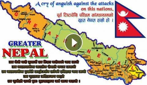
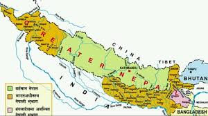
was about 60% greater than the current Nepal named "Greater Nepal". The Greater Nepal’s border is from Sikkim-Jalpaiguri
in the east and the border goes up to Sutlej in the west part of current Nepal
.
The Real concept of Greater Nepal at the current situation
is that Nepal should get back those territories that were ceded because of the
Sugauli treaty. Currently these territories are within India
which were left by the British.
When we go to the History of Greater Nepal, Nepal a separate
country that was not colonized by the British Empire. During the time of 800 BCE–300 CE for about 1,225 years, Nepal
was ruled by the Kirat
dynasty. Then, the
rule of Kirati's dynasty was about to end and Lichhavis were emerging. Nepal
was divided into 53 pieces during Lichhavi's era. Later the Prithivi Narayan
Shah started to unite the greater Nepal.
Here are the maps in the picture regarding the
territory of greater Nepal.
These are the Greater Nepal Real Maps You Must Know
 |
| Add caption |
 |
| Greater Nepal Map with Details |
 |
| Greater Nepal Map allegation by Greater Nepal Morcha |


