In its political map, Nepal has not comprised Limpiyadhura which is some 30 kilometers northwest of Kalapani, which is the last border point on Nepal's political map.
Limpidhura is considered the origin of the Mahakali river which demarcates the border between the two countries as mentioned in the Sugauli Treaty signed between the then East India Company and Nepal in 1815.
Nepal has border disputes with neighboring India at 71 places in 23 districts. Surrounded by India on the eastern, southern, and western sides, Nepal shares open border with the neighboring country.
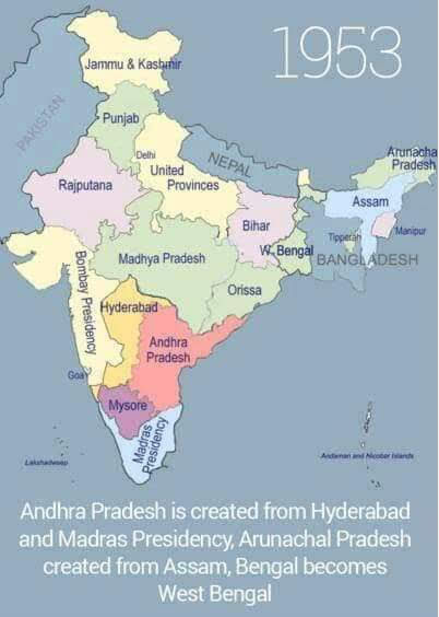
See the Nepal India Map Picture which was printed from 1947 to 2014. You can see there was Limpidhura and other territories mentioned which was gradually removed from 2014. these pictures speak.
This picture was just after amalgamation of states in India
During the central India and central provinces are merged to create Madhya Pradesh.
In 1953 andhrapradhes is created from hydrabat and Madras Presidentcy.


